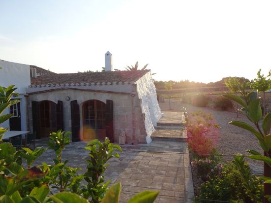
An inland municipality with two seaside places on its coast, Alaior is where Menorca keeps its farmland, its stone and much of its everyday life.
124stays in the IMPT hotel database
2area guides
Menorcaisland
Alaior is the municipality at the middle of Menorca, and it answers a simple question: where do you stay if you want the island rather than a resort? The town is compact and working, the interior is farmland and dry stone, and the coast is limited to two places, Son Bou and Cala en Porter. This guide covers all three.
01
The middle of the island
Alaior is the municipality at the centre of Menorca, and it reaches the sea only along a short stretch of the south coast. Its land runs from the town itself, on a low limestone rise, south across farmland and dry stone walls to Son Bou and Cala en Porter. There is no marina and no long hotel strip along a main road. The scale is rural: fields, quarries, scattered farms and small lanes.
That shapes who the municipality suits. It is a base for people who want the island rather than a resort: a town with shops, a market and somewhere to eat on a Tuesday in February, and beaches a short drive or a long walk south. Families tend to look at the two coastal areas. Walkers and cyclists look at the interior lanes. Anyone who wants a lift to the sand every hour should stay on the coast instead.
02
Alaior town and its villages
The town is compact and pale, built of the limestone that comes out of the ground all around it. Streets climb towards the church of Santa Eulàlia, which stands on the high point, and the lanes below it keep their shade through the middle of the day. Shopfronts are ordinary and pavements are narrow. This is a working town rather than a staged one: busy in the morning, quiet after lunch, lively again by evening.
Outside the town the municipality is a scatter of hamlets and farm buildings. Sant Climent is the largest of the villages, a small settlement with a church and a crossroads, well placed for the lanes that run south towards the coast. Elsewhere the pattern is single houses, gates, fig trees and walls, with the sea appearing as a pale line beyond the fields. Little here is arranged for visitors, and that is the reason to come.
A night-time jaleo with horses at the Sant Llorenç festival in Alaior, Menorca03
Son Bou and Cala en Porter
The municipality's coast holds two places with their own guides on this site. Son Bou is the long beach on the eastern side, sand and dunes with a shallow approach and a marsh behind it, and it carries the summer population that a beach of that size attracts. The Son Bou guide covers the sand, the access and the seasonal rhythm in detail. It is the busiest stretch of the municipality from June to September and the emptiest from November to April.
Cala en Porter sits further west, where a ravine opens between cliffs to give a cove rather than an open beach, sheltered and narrow, with the village above it on the rim. The Cala en Porter guide covers the cove, the cliff path and how the place works in and out of season. Between the two, the coast is cliff and rock, with no road running along it. Access is by lanes from the town, and the last stretch drops steeply.
04
The south coast on foot
The Camí de Cavalls, the historic bridleway that circles Menorca as the GR 223, runs through the municipality along its southern edge. The full route is about 185 km in 20 stages, and the Alaior stretch is one of the gentler ones: cliff top, a few ravines, long views east and west. Most people walk it in sections, using the town or the coast as a base. Signs are frequent where the path meets a road.
Access matters more than distance here. Paths drop to the coast from the lanes above Son Bou and Cala en Porter, and the route is waymarked, but there is little shade and no reliable water between the built-up edges. In summer the walking is best early or late. Shoes with a grip on limestone, a hat and a full bottle are the practical basics. Limestone is slippery when wet, and the winter path is often muddy.
WaymarkingThe GR 223 signs are frequent where the path meets a road; carry a map at junctions.
WaterThere is no reliable water on the cliffs; fill bottles in the town or the villages.
ShadeThe south coast path is exposed; walk early in July and August.
AccessLanes from Alaior town and the two coastal areas reach the path.
05
Nature behind the beach
Behind Son Bou the sand gives way to dunes and then to a reedbed, wet in winter and spring and dry by August. It is a brackish margin of a kind Menorca has few of, and birds use it on migration. The rest of the municipality's coast is cliff and rock, with the clear shallow water that comes from a seabed held in place offshore. The dunes are the beach's reserve of sand, and the paths through them exist to keep feet off the grass.
The posidonia is the reason the water looks the way it does: a flowering seagrass found only in the Mediterranean, growing from the shallows to about 30-40 m. It is protected, anchoring over the meadows is regulated under a Balearic decree, and mooring buoys are installed in some bays in summer. Ashore, the same logic runs: keep to the paths and the coast keeps its shape.
The posidonia is the reason the water looks the way it does.
Protect itDo not cross the dunes or take the posidonia that washes up; both hold the beach in place. Report damage, or boats anchored over the meadows, to the Consell Insular de Menorca.
06
Stone and history
Menorca's prehistoric monuments put the island on the World Heritage list in 2023 as Talayotic Menorca, and Alaior has its share. The talayotic village of Torre d'en Galmés stands on the south side of the municipality, a settlement of stone circles, walls and a taula, with a view that explains why the site was chosen. Other talayots and navetes sit in fields along the lanes, unsigned. Most are reached by a stile and a path across a field, and they are usually empty.
The later stone is everywhere: dry stone walls dividing fields, the pale blocks of the town, terraces on the slopes. Alaior grew as a farming and quarrying place, and both trades left their mark on the buildings and the roads. The church of Santa Eulàlia and the older houses around it are built from the same stone as the ground you walk on.
The dunes of Son Bou on Alaior's south coast, Menorca07
Food, markets and the inland larder
Alaior's hinterland is farmland, and the food follows from it: vegetables, cheese, sausages and the cheese that carries the Mahón-Menorca protected designation of origin, made across the island from the milk of local herds. A weekly market brings producers into the town, and the day changes with the season, so confirm it with the town hall before planning a morning around it. The market is small and practical rather than a visitor attraction, which is what makes it worth the trip.
Restaurants in and around the town work to the island's calendar, busy from May and quiet after October. Fish comes up from the ports, lobster and caldereta belong to the island's repertoire, and the inland kitchens cook with what the farms and the sea send. Eating in Alaior is calmer than on the coast, and the town's places tend to stay open through the winter when the coastal ones close.
Market dayThe weekly market day changes with the season; confirm with the Ajuntament d'Alaior.
CheeseMahón-Menorca cheese carries a protected designation of origin and is made across the island.
Winter openingInland kitchens tend to stay open through the winter, unlike the coastal ones.
08
Getting there and getting around
Menorca Airport (MAH) sits about 4-5 km south-west of Maó, in the eastern half of the island. The straight-line distance from the airport to Alaior town is shown on this page; road distance and journey time are a different matter and depend on the route. Buses link Alaior with Maó, with more services in summer, and the island bus operator publishes the current timetable. The airport bus runs to Maó, where you change.
A car makes the municipality easier, because the town, the two coastal areas and the lanes are spread out and the buses to the coast are seasonal. Cycling works on the interior lanes, which are quiet and rolling rather than flat. The Camí de Cavalls needs no vehicle at all. Parking in the town is on the edge rather than in the middle, and beach parking fills early in August.
Check before you goBus timetables, seasonal beach services and the opening of coastal places all change. Confirm with the island bus operator and the Consell Insular de Menorca before you rely on them.
09
When to go and what closes
The town of Alaior works all year. The coast does not. Son Bou and Cala en Porter fill from late spring and empty after the season, and many hotels, beach bars, boat trips and seasonal buses close roughly from November to April. Winter is quiet, sometimes wet, and good for walking; the town keeps its market and its ordinary life. Accommodation charges the Balearic sustainable tourism tax per person per night, and rates change, so check the Govern de les Illes Balears.
Late spring and early autumn are the best compromise: the sea is about 18-19 °C in May and 23-25 °C in September, there are fewer people, and most places are open. August is the busiest month, with the sea at about 25-26 °C and parking gone by mid-morning. Winter swimming happens at 14-15 °C in February and March, for those who like it cold. The south coast is sheltered from the tramuntana, the north wind that clears the island and cools it.
May and JuneWarm sea, open businesses and space on the paths before the school holidays.
September and OctoberThe sea stays warm into October and the coastal places wind down gradually.
AugustBusiest and hottest; book ahead and start walks early.
WinterThe town is open, the coast is shut and the island is at its quietest.
Stays in Alaior: the first 9 of 124 stays in the IMPT hotel database in or close to Alaior, five-star first, then four-star, then by guest score. Each button opens live prices for your dates in the IMPT app.
Alaior sits in the centre of Menorca, inland from the south coast, with Son Bou and Cala en Porter on its own stretch of shore. It is one of the island's eight municipalities, with a compact town on a low limestone rise. Maó lies to the east and Ciutadella to the west.
Should you stay in Alaior town or at Son Bou or Cala en Porter?
Alaior town suits people who want ordinary island life, a market and somewhere open in winter, with the coast a short drive south. Son Bou and Cala en Porter suit families and anyone who wants the beach on foot, and they are seasonal, with much closed from November to April. Both coastal areas have their own guides on this site.
Does Alaior have beaches?
Two, in effect. Son Bou is a long sandy beach with dunes and a marsh behind it, and Cala en Porter is a cove at the mouth of a ravine. The rest of the municipality's coast is cliff and rock, walked by the Camí de Cavalls but not reachable by road.
How do you get to Alaior from Menorca Airport?
Menorca Airport (MAH) is about 4-5 km south-west of Maó. Buses run from the airport to Maó, where you change for Alaior, and services are more frequent in summer. By car the route is straightforward, and the straight-line distance to Alaior town is shown on this page. Check current timetables with the island bus operator.
Is Alaior a good base for the Camí de Cavalls?
Yes. The GR 223 crosses the municipality along the south coast, and lanes from Alaior town, Son Bou and Cala en Porter reach it. The Alaior stretch is gentle, with cliff tops and a few ravines, but shade and water are scarce. Most walkers do it in sections and return to a bed in the town or on the coast.
What can you see in Alaior town itself?
The church of Santa Eulàlia on the high point, the lanes falling away from it, and the ordinary business of a Menorcan town: shops, a weekly market, and bars that fill in the evening. The talayotic village of Torre d'en Galmés is a short way south, and the coast is beyond it.
When is the best time to visit Alaior?
May and June, or September and early October. The sea is warm, the paths are open and the town is working normally. August is the busiest month and the coast fills. Winter is quiet and good for walking, but many coastal businesses close roughly from November to April.
Is Alaior open in winter?
The town is. Shops, the market and the restaurants in the centre keep going, and the prehistoric sites and lanes are walkable. The coast is not: Son Bou and Cala en Porter lose most of their hotels and beach bars roughly from November to April, and buses and boat trips thin out. Check before relying on anything seasonal.
What food is Alaior known for?
Cheese above all, in the form of Mahón-Menorca, which carries a protected designation of origin and is made across the island from local herds. Inland kitchens work with vegetables, sausages and what the ports send, and the island's repertoire includes lobster and caldereta. The weekly market is the place to see what the farms produce.
Photo credits: Evelyne Bazalgette, CC BY-SA 3.0, via Wikimedia Commons; Slastic, Public domain, via Wikimedia Commons; Discasto, CC BY-SA 4.0, via Wikimedia Commons.
Watch
Menorca
Menorca's coast in three scenes, ending with sunset at Fornells.
Captions are built in; the transcript is on the Menorca page.
Video: Raymond Petrik, Angelo Esposito, Agusti Perez on Pexels