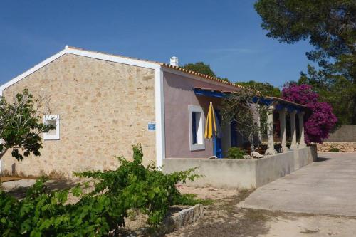
A network of signed tracks crosses Formentera's farmland, pine woods and salt flats. The distances are short, the ground is gentle and the sea is rarely far from the handlebars.
All yearbest time
Sant Francescnearest area to stay
3.9 kmfrom La Savina port, straight line
The green routes, the circuits verds, are Formentera's own signed trail network: tracks and quiet lanes linking Sant Francesc Xavier with the coast, the salt flats and the lighthouses. They are meant for walking and cycling. No special fitness is needed and no guide is required, only a map, water and a little care on sandy ground.
01
What the green routes are
Formentera is about 19 km long and 83 km² in area, and a bicycle covers it comfortably. The Consell de Formentera has signposted a set of green routes, the circuits verds, on farm tracks, old paths and minor lanes. They link the villages with the coast, the two lagoons and the lighthouses. The surface is mostly earth, sand and broken tarmac rather than smooth asphalt, so a bike with wider tyres is more comfortable than a racing machine.
The routes are marked and continuous, which matters on an island where many farm tracks look alike. Riding them takes in farmland divided by drystone walls, low pine and juniper woodland, the salt pans of Estany Pudent and stretches of open coast with the sea always in view. Nothing on them is technical. The one real climb is the road up to La Mola, a plateau about 190 m above the sea, and that is a matter of gearing rather than skill.
02
Getting to the routes
Formentera has no airport. The usual approach is to fly to Ibiza (IBZ) and take a ferry from Ibiza Town port to La Savina, which takes about 30 to 35 minutes on fast boats and about an hour on conventional ones. Sailings are frequent in season and fewer in winter, so check the operators for the travel date. The green routes begin within a few minutes of the port.
Sant Francesc Xavier, the capital, is the natural base: central, open all year and within reach of the network in every direction. Between villages the tracks are the point, and the distances are short enough that a half day takes in a real piece of the island. Buses run between the villages, with fewer services outside the season, and space for bicycles is limited, so ask before relying on it.
By seaFerries from Ibiza Town reach La Savina all year, with fewer crossings in winter.
By airFly to Ibiza, then transfer to the port; Formentera itself has no airport.
Start pointsLa Savina and Sant Francesc Xavier both sit on the network, so start from either.
HireBikes are hired in and around the main villages, with more choice in season.
The Camí de sa Guia track, with Es Vedrà and Ibiza beyond, Formentera03
When to ride
The routes can be ridden all year. Spring and autumn give the best conditions: warm air, cooler ground and fewer people on the tracks. In July and August the heat limits the ride more than the distance does, and the middle of the day is better spent in the water. Set off early, carry more water than seems necessary and plan a short ride rather than a long one.
Winter is quiet and bright, with some of the clearest light of the year and empty tracks. Much of the island's tourism business closes roughly from November to April, so hire shops, cafés and some seasonal buses may not be there; the main villages stay open and the ferries keep running. Wind is the other variable. Formentera is low and exposed, and a headwind on the way to Cap de Barbaria can make a short ride feel long.
04
Routes worth riding
A short loop through the middle takes in the two lagoons, Estany des Peix and Estany Pudent, both inside Ses Salines Natural Park, then returns through farmland and low pine. It is the gentlest introduction to the network and easy to shorten if the wind picks up. Birdlife on the water is best in the quiet hours, and the salt pans themselves are worth stopping for rather than riding past. Salt is still harvested here.
The longer day is south to Cap de Barbaria and its lighthouse, then back by a different track, or east and up to La Mola. Both ends of the island have a lighthouse and a stretch of open ground around it. Riders with children tend to stay with the village links and the lagoons; riders with more time take the coast road down to Platja de Migjorn and Es Caló de Sant Agustí.
Lagoons loopA short, level circuit past Estany des Peix and Estany Pudent.
Cap de BarbariaSouth to the cape and its lighthouse, on open ground with little shade.
La MolaEast and up to the plateau, the island's one proper climb.
Village linksSant Francesc Xavier, Sant Ferran de ses Roques and Es Pujols sit close together.
05
Rules on the tracks
The green routes cross private farmland and protected ground, and the rules are simple. Stay on the signed track, even where a shortcut looks obvious. Close gates behind you, do not widen gaps in drystone walls, and keep off the dunes and the juniper. Farmers work these fields, so a gate left open is a real problem rather than a small one. Ground that looks bare here is often alive: sand, low plants and the roots that hold the coast together.
Where the routes share space with walkers, give way and slow down. In the villages, ride at walking pace and park without blocking doorways or paths. Inside Ses Salines Natural Park and around the lagoons, the usual rules for protected areas apply, so keep to marked paths and keep noise down. The Pitiusan wall lizard lives here and nowhere else, and it does not move fast enough for a bicycle.
Vineyards beside a country track on Formentera
The signed track carries you from salt pan to pine wood without a single wrong turn.
Protect itThe tracks pass through farmland and protected ground. Keep to the signed route, close gates, and leave the juniper, dunes and drystone walls as they are.
06
What to bring
The basics are water, sun protection and a repair kit. Between villages there are few places to refill a bottle, and shade is scarce on the southern and eastern stretches. A small pump, a spare tube and tyre levers cover most of what goes wrong on sandy tracks. If the ride runs into the evening, lights are needed after dark, and a light also makes a bicycle visible on unlit lanes.
A lock is worth carrying, even on a quiet island, because a bike left at a beach or a lighthouse is easy to move. A phone with a map downloaded in advance is more reliable than a paper map in wind, and a light layer helps against the sea breeze even in summer. Sunglasses, a hat and something to swim in complete the list, and a bag that closes keeps sand out of everything.
WaterCarry more than seems necessary; refill points between villages are scarce.
Repair kitA spare tube, levers and a pump for sand and thorns.
SunHat, sunglasses and high protection for exposed stretches without shade.
LockUseful at beaches and lighthouses, where bicycles wait unattended.
LightsNeeded after dark and handy on shaded tracks and lanes.
07
What is nearby
The network passes close to most of what Formentera is known for. Ca na Costa, the megalithic tomb near Es Pujols, is about 4,000 years old and the oldest known monument on the Pitiusas. Sant Francesc Xavier has its fortified 18th-century church, built as a refuge. At Es Caló de Sant Agustí the old boat houses sit at the water's edge, and the lighthouse on El Pilar de la Mola marks the eastern end of the plateau.
Swimming is part of a cycling day here. Ses Illetes and the sand at Platja de Migjorn are the obvious stops, and Cala Saona is a sheltered bay on the western side. The lagoons reward a pause with binoculars, and the paths around Estany des Peix are short enough to walk after leaving the bike. Espalmador, the islet off the northern tip, is reached by boat rather than by bike, and crossings are seasonal, so check with operators before building a day around it.
08
Practical notes
Two things are worth checking before a cycling trip. First, the Consell de Formentera caps the number of visitor vehicles in high season, so if a car or a camper is part of the plan, confirm the current rules with the council. Second, hire availability thins outside the season, and some places close roughly from November to April. A bike brought from home avoids both problems, provided it travels safely.
On the ground, village parking is limited in summer and best left to cars. Phone coverage is generally good but patchy in dips and behind dunes. Ferries back to Ibiza run through the day, with fewer crossings in winter, so check the last sailing rather than assuming one. In an emergency, call 112. The main towns stay open all year, but much of the seasonal business does not.
Check before you goVehicle limits, hire availability and ferry times all change with the season. Check the Consell de Formentera and the ferry operators before fixing dates.
Where to wake up
Stays near the green routes
Stays near the green routes: the first 6 of 25 stays in the IMPT hotel database in or close to Sant Francesc Xavier, the nearest area to Cycle the green routes, five-star first, then four-star, then by guest score. Each button opens live prices for your dates in the IMPT app.
The green routes, or circuits verds, are a signed network of tracks and minor lanes across Formentera, marked by the Consell de Formentera for walking and cycling. They link the villages with the salt flats, the lagoons, the coast and both lighthouses, and they avoid the main roads wherever a farm track will do.
Where do the green routes on Formentera start?
La Savina and Sant Francesc Xavier are the simplest starting points, since both sit on the network and are open all year. From Sant Francesc Xavier the tracks run in every direction, so a loop can begin at the edge of the village. Bikes can be hired in and around the main villages.
When is the best time to cycle the green routes on Formentera?
Spring and autumn suit most riders: warm, bright and quieter on the tracks. Summer is workable if the ride starts early and finishes before the middle of the day, when heat becomes the limiting factor. Winter is clear and empty, though many seasonal businesses close roughly from November to April.
Are the green routes on Formentera suitable for children?
The village links and the lagoon circuits are short and mostly level, which suits families, and distances can be cut easily. The open stretches towards Cap de Barbaria and the climb to La Mola are harder and more exposed. Traffic is light but present, so children should ride in sight on the lanes.
What is the surface like on the green routes on Formentera?
Expect earth, sand, broken tarmac and some stony sections rather than smooth asphalt. Wider tyres make a real difference, and a mountain bike or a robust town bike is more comfortable than a road bike. After rain some tracks hold water and soften, so allow more time and pick lines carefully.
Is water easy to find along the green routes on Formentera?
No. Between the villages there are few places to refill a bottle, and shade is scarce on the southern and eastern stretches. Carry more than seems necessary, especially in summer, and treat a stop in Sant Francesc Xavier, Sant Ferran de ses Roques or Es Pujols as the moment to top up.
How long does it take to cycle the green routes on Formentera?
There is no single answer, because the network is a set of routes rather than one. The island is about 19 km long, so a half day covers a real section at an easy pace, and a full day reaches a lighthouse and returns. Heat and wind decide more than distance does.
Can the green routes on Formentera be ridden out of season?
Yes. The tracks stay open and the main villages remain active all year. What changes is the supporting business: some hire shops, cafés and seasonal buses close roughly from November to April, and ferries are fewer in winter. Check opening and crossings before travelling with a bike out of season.
Are bikes easy to hire for the green routes on Formentera?
Bicycles are hired in and around the main villages, with the widest choice in high season and thinner availability outside it. Book ahead in July and August rather than arriving and hoping. Check the bike before setting off: brakes, tyre pressure and a working lock matter more than the model.